BEREKUM DISTRICT PROFILE
Overview
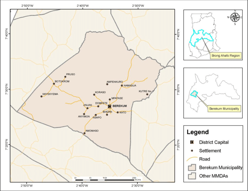
The Berekum East Municipal, with Berekum as its capital, is one of the twelve administrative districts of the Bono Region. Covering an area of approximately 1,100 km², it is located about 35 km west of Sunyani, the regional capital.
The Berekum East Municipal is bordered by:
- North: Berekum West District
- Northeast: Tain District
- Southwest: Dormaa East District
- Southeast: Sunyani West District

Population
As of 2023, the estimated population of the Berekum East Municipal was 110,762, based on projections from the 2021 Population and Housing Census, with an annual growth rate of 2.3%.
Ethnic Groups
The municipality is predominantly inhabited by the Akan ethnic group, with significant minorities including Moshie, Dagarti, Kusasi, Bimobas, Ewe, and other groups from northern Ghana.
Religion
The population is primarily composed of Christians, Muslims, and traditional worshippers.
General Administration
The Berekum Municipal Assembly (BMA), headed by a Municipal Chief Executive (MCE), oversees the administration of the municipality. For healthcare delivery, the municipality is divided into five sub-municipals:
- Berekum Central
- Kato
- Mpatasie
- Zongo
- Biadan
Health Administration
The Municipal Health Directorate (MHD), an administrative arm of the BMA, is responsible for health service delivery in the municipality. The MHD is located in Berekum.
Topography and Climate
The vegetation in the municipality mainly consists of semi-deciduous forest. The climate features two main seasons: the rainy and dry seasons. The area experiences a double maxima rainfall pattern, with annual rainfall ranging between 125 mm and 175 mm. The major rainy season peaks between April and July, followed by a minor season in September and October.
Economy
Farming and trading are the primary socio-economic activities in Berekum East Municipal. Major food crops include cassava, plantain, and cocoyams, and many inhabitants are also involved in animal husbandry. Additionally, there is a considerable number of public and civil servants employed in various institutions within the municipality.
Social Amenities
- The road network in the municipality is generally poor, with a few tarred roads and mainly feeder roads, many of which become unmotorable during the rainy season. The road linking Berekum to Sunyani is tarred, but other roads within the municipality are not, complicating transportation during rainy periods.
- Potable water is primarily supplied through boreholes and deep wells. Berekum and other major towns have access to treated pipe-borne water, while some communities rely on streams, ponds, and rivers for their water needs.
- Most major towns are connected to the national electricity grid, although several communities are still awaiting connection.
Traditional Authorities
Traditional authorities play a significant role in the local governance structure, organizing communities for health delivery activities such as immunization and health education. Each community has its own chief, and the municipality includes several paramount chiefs.
Health Facilities
- The municipality has a total of twenty health facilities, including:
- Hospitals: 2 (Private and CHAG)
- Health Centres: 4
- CHPS Compounds: 8
- Private Maternity Homes: 3
- Private Eye Care: 1


