Political Aministration
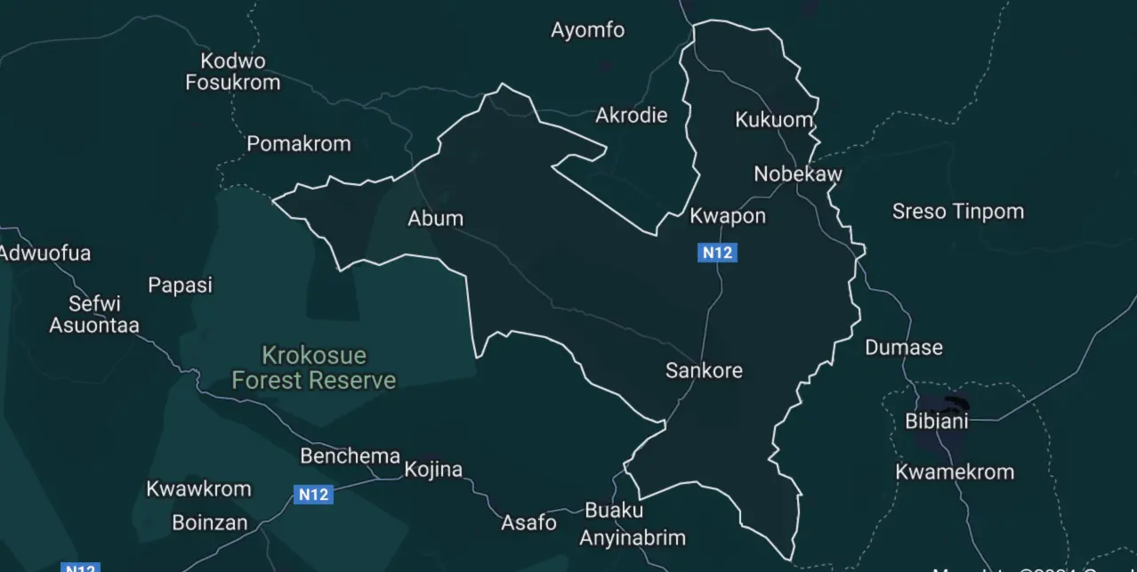
The Asunafo South District is one of the six (6) administrative districts in the Ahafo Region. It is carved out of the then Asunafo District Assembly, after it was split into Asunafo North and South under the Legislative Instrument (L.I) 1773 in line with government’s objective of deepening decentralization. The district was established in November 2004 with Kukuom as the district capital. The district lies within Latitudes 6°41(6.6833°) North and Longitudes 2°27(-2.45°). It covers a total land surface area of about 922 sq km and has about 150 settlements. The district shares boundaries with Asunafo North Municipal to the North, Juaboso District to the South-West, Sefwi-Wiaso District (Western Region) to the South-East and Atwima Mponua District (Ashanti Region) to the East. The district administratively has four (4) sub-districts, namely Kukuom, Kwapong, Sankore and Abuom with the district capital Kukuom about 11 km (approximately 15-minute drive) from Goaso, the regional capital of Ahafo region.
Map Of Asunafo South By Sub-District With Facilities

Climate and Vegetation
The district lies within the wet semi-equatorial climatic zone characterized by double rainfall maxima occurring between June and October. The first and major rainy season occurs between April and July whilst the second and minor rainy season is from September to October. The average annual rainfall at the district ranges between 125 cm and 175 cm whilst the dry season which starts from November to March is usually characterized by the harmattan’s dry and dusty winds. The vegetation falls in the moist semi-deciduous forest region of Ghana where different trees species of economic value such as Onyina/Ceiba, Dahoma, and Sapele Mahogany, Framo, etc. are found. However, due to the indiscriminate and illegal felling of trees for timber resources and other traditional farming practices such as slash and burn, charcoal production, among others, the original forest vegetation cover has been depleted over time into secondary forest. The double rainfall experienced by the district is favorable for the cultivation of cash crops and afforestation programs.
Demographic Characteristics
The Asunafo South District is the only designated deprived district in the Ahafo region. It has a total population of about 95,582 with males constituting majority (51.2%). The population density is around 99.5% with women in reproductive age (WIFA), expected delivery/pregnancy, children under-five years and adolescents constituting 22,940; 3,823; 17,683 and 21, 411 respectively. The urban population constituted 32% of the total population, while the rural constitutes 68% according to the Ghana Statistical Service, 2021 census.
Health Care Services
Asunafo South District has a total of twenty-six (26) Health facilities with one (1) Public District Hospital, two (2) Private Hospitals, three (3) Health Centres (2 designated model health Centres for operationalization of Network of Practice), one private maternity home and eighteen (18) Community-Based Health Planning Services (CHPS) facilities.
Education
The district has a total basic school infrastructure of 301 currently with 236 publicly owned. This includes 109 Kindergarten, 109 primary schools, 80 Junior Secondary Schools, 2 Senior Secondary Schools, and one (1) tertiary (Nursing Training) institution in Kwapong.
Economic Activity
Locally, the economy is predominantly agrarian one followed by the service sector, manufacturing and processing activities, commerce, informal small-scale businesses, and marketing. About 74% of the population engaged in Agriculture at subsistence level. However, most peasant farmers largely rely on rain-fed agriculture and employ a rudimentary traditional system of farming. The main food crops cultivated are maize, cassava, rice, plantains, and coconuts. And the principal cash crops grown in the district include cocoa, oil palm, citrus fruit, coffee, and cashews.


