Overview
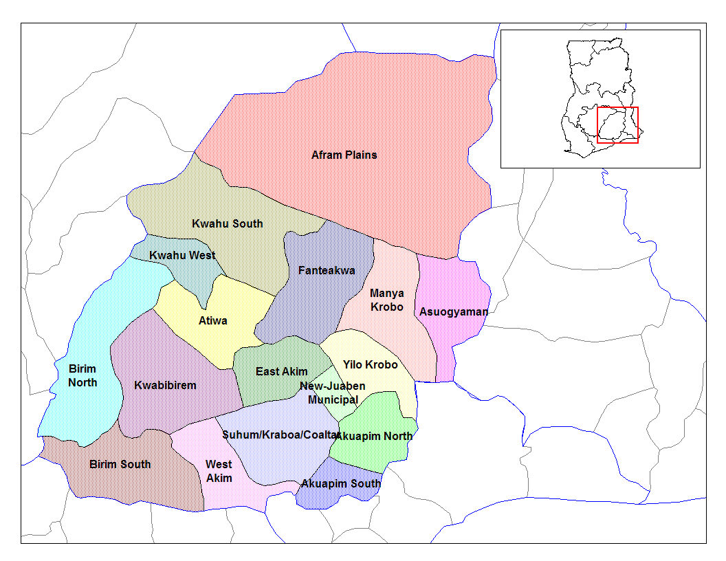
Asuogyaman District is one of the thirty-three districts in the Eastern region of Ghana. Asuogyaman District was created under local government instrument LI 1431 of 1988 because of the Ghana Government re-demarcation exercise carried out to operationalize the decentralization programme in the country from the defunct Kaoga District, which had Samanya as the capital.
Health
The Asuogyaman District Health Directorate has been divided into six subdistricts in line with the provisions of the Local Government Act, 467(1993) and the health service administrative goal of universal coverage. They are Anum/Boso, Akwamufie/Apeguso, Atimpoku, Adjena/Gyakiti, Akosombo, and Senchi subdistricts respectively. The district is made up of one constituency with 35 electoral areas with their corresponding unit committees.
The Asuogyaman District Health Directorate serves 156 communities in the six sub-districts. The Asuogyaman District Health Directorate (ADHD) oversees the functionality of all the health facilities in the district. The Asuogyaman District Health System is based on a 3-tier Primary Health Care.
• The district
• The sub-district and
• The community-level
TYPE OF FACILITY NUMBER OWNERSHIP
Hospital 1 VRA
Public Health Centres 10 Ghana Health Service
Mission Health Centres 1 Salvation Army
Private clinics & Health Centres 6 Akosombo Industrial Company Limited Clinic, Hashem Health Care Services, NAABS Memorial Clinic, Destiny Amegbey HC, Hill Cross Medical Centre, Volta River Estate Limited (VREL) Health Services
Private Laboratory 1 AIDMEB Diagnostics
Private Herbal Clinic 1 Akwamuman Herbal Clinic
Outreach Centres 94 Ghana Health Service
CHPS 35 functional Ghana Health Service

Geography
The Asuogyaman District is located approximately between latitudes 6º 34º N and 6º 10º N and longitudes 0º 1º W and 0º14E. It is about 120m above Mean Sea Level (MSL). It covers a total estimated surface area of 1,507 sq. km, constituting 5.7 percent of the total area of the Eastern Region. Afram Plains South District borders the district to the north and the Upper and Lower Manya districts to the south and west. Asuogyaman is a traditional district situated between the Volta and Eastern Regions and they share borders to the east with Kpando, North Dayi, Ho, and the North Tongu Districts of the Volta Region. The topography of the district is generally undulating. It is mountainous and interspersed with low-lying plains to the west and the east. The Volta River cuts through such ridges to create a gorge ideal for the construction of the Volta Dam at Akosombo. On average, the highest of the peaks in the district ranges between 700 – 800m above sea level.
Climate
The Asuogyaman District lies within the Dry Equatorial Climate Zone, which experiences a substantial amount of precipitation. This is characterized by a double maxima rainfall, which reaches its peak period in May – July, and the minor season occurs between September and November. Annual rainfall usually starts in April with the peak month in June and ends in November. The dry season sets in November – December and ends in March. The annual rainfall is between 67m and 1130mm; temperatures are warm throughout the year with a maximum monthly mean of 37.2ºC and a minimum of 21.0ºC. Relative humidity is generally high ranging from the highest of 98% in June to 31% in January.


