DDHS and district profiles
Profile
Background
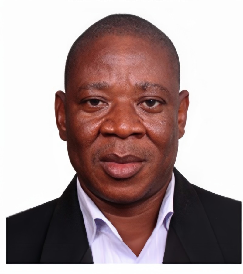
Dr. Justice Thomas Sevugu currently serves dual roles as the Municipal Director of Health Service for Atwima Nwabiagya and as the National Chairman (Dean) of the District Directors of Health Group in Ghana. He is recognized for his extensive expertise in Health Systems Management, Public Health Policy & Practice, and Research, characterized by his adaptive leadership and commitment to team development.
Education
Dr. Sevugu holds a PhD in Public Health from the University of Central Nicaragua, North America, specializing in Public Health Management and Applied Epidemiology. He completed a Fellowship in International Program Public Health and Leadership at the Evans School of Public Health and Leadership, University of Washington, USA, and earned his Master of Public Health from Kwame Nkrumah University of Science and Technology in Kumasi, Ghana. Additionally, he holds a BSc, Diploma in Community Health (Disease Control), and certificates in Leadership & Management in Global Health and Epidemiology for Global Health from various institutions.
Work
Dr. Sevugu’s career highlights include roles as a STOP/Policy consultant for polio eradication and the Expanded Programme on Immunization (EPI). He has led investigations into disease outbreaks across Ghana, including Meningitis in Pru East (Bono East region), Polio in Bono, and outbreaks of Mpox, Yellow Fever, and Measles in the Ashanti regions. His contributions have enhanced disease surveillance and control measures, earning him Presidential accolades for his leadership during the Covid-19 pandemic. Dr. Sevugu has also influenced health policies and guidelines nationally and internationally, contributing to initiatives such as the National Community Health Worker Programme and guidelines for Covid-19 vaccination routinization. He is a respected scholar with publications focusing on maternal health, disease control, disease outbreaks, and HIV/AIDS, reflecting his commitment to improving public health through research and evidence-based interventions.
Professional Experience
EDUCATION
Other Training
Overview
Tain District was created in June 2004 by LI 2090, in the Brong Ahafo Region. It lies within latitudes 7 ½ and 8o 45` North and longitudes 2o 52`West and 0o 28` East. In terms of land area, Tain District covers 2,700sqkilometers.
The District shares common boundaries with Wenchi District to the East, Jaman North to the West, Sunyani West to the South and Berekum District to the South West. It is also bounded by the Banda District to the North, La Cote d’Ivoire to the North West. Nsawkaw, the District capital is 18 miles from Wenchi, the capital of Wenchi District Assembly which Tain was carved out.
The location of the big towns like Debibi, Brodi, Seikwa and Badu are far away from the district capital, Nsawkaw, and nearer to Districts like Berekum, Sampa and Sunyani deprive the district of the needed revenue as the big towns in Tain District transact business with these nearby Districts. This implies that there is the possibility of large amount of waste being generated in these big towns. Also, the fact that traders from other districts come in and trade means that in assessing the current and projected water and sanitation needs of the people, those who come from outside the district should also be catered for.
Condition of the Physical and Natural Environment
Climate
The temperature in the Tain District is generally high averaging about 24.5oC (779oF) throughout the year (Benneh and Dickson, 1970). Average maximum temperature is 30.9oC and minimum of 21.2oC. The hottest months are February to April. The rainy season occurs between April and October with a short dry period in August. The average annual rainfall is about 1,296.8mm.The month with the highest amount of rainfall is May with a maximum rainfall of 189.2mm with January recording no rainfall. The district experiences an average of 4 months of rain.
Ecological Zone and Vegetation
The original forest vegetation has been subjected to degradation, caused mainly by the indiscriminate bush fires, slash and burn agriculture, logging and felling of trees for fuel over the years.
The cumulative effect is that secondary vegetation occurs in cultivated areas. Timber species like Odum, Sapele, Wawa and Mahogany are found in places around the northern part of the District. In the semi-derived savanna areas, there are the absence of large economic trees as a result of logging, charcoal burning and mechanized farming. The combination of the vegetation zones – guinea savannah, transitional zone and the forest permit the cultivation of a variety of crops – cereal, tubers and vegetables and even animal rearing.
Population Size, Growth Rate and Density
The district has 143 settlement communities with 22 towns and 121 villages with Indigenes 48% and Settlers 52%.
The district projected population size as at 2020 was 118,928 with males being 58,730 whilst females 60,198 (Source: Projections from 2010 census by DPCU). The population a growth rate of the district is 2.6%, and density of the district is 42.70 persons per square kilometer, 60.30sq km below the national figure of 103 persons per km2 (TDA DMTDP 2022-2025). The projected population for the District is 123, 003 for the year 2024. This is expected to increase to 162, 474 in 2032 and 210, 717 in 2042.
Age and Sex Composition
Analysis of the population structure of the district indicates that about 49.4% of the total population are females whiles 50.6% are males. This resulted in a male – female ratio of 1:0.9 which almost conforms to the regional sex ratio of 1:1.008.
THE DISTRICT HEALTH DIRECTORATE
The Tain District Health Directorate of the Ghana Health Service; located at the district capital Nsawkaw is ultimately responsible for directing and managing health related services in the district. The delivery and management of health services at the population-level or individual level are organized through the collaboration with the District Health Directorate delivered through sub-district and community levels.
The district has been demarcated into four sub-districts namely Nsawkaw, Seikwa, Badu and Debibi to facilitate access to health services.
In line with the constituencies, the district has been demarcated into 29 CHPS zones. There are 5 Health Centers, 5 Private health facilities and 11 CHPS compounds.
All the Health Facilities in the district provide both clinical and preventive services.
Facility Infrastructure, Ownership and Population
|
GOV’T | PRIVATE | CHAG | TOTAL | POPULATION | |
---|---|---|---|---|---|---|
NSAWKAW | 4 | 2 | 0 | 6 | 34,441 | |
BADU | 4 | 0 | 1 | 5 | 31,980 | |
SEIKWA | 6 | 1 | 1 | 8 | 29,521 | |
DEBIBI | 3 | 0 | 0 | 3 | 27,061 |
Health facilities are evenly distributed across the district. They are made of 17 government health facilities, 3 private and 2 CHAG facilities. These consist of 11 CHPS compounds which are in the rural part of the district, 5 health centres are mostly found in the urban part of the. The district hospital serves as the main referral point for all the facilities in the district.
Top 10 Morbidity
• Malaria
• Acute Respiratory Tract Infection (ARI)
• PUO (Not Malaria)
• Diarrhoea
• Intestinal Worms
• Rheumatism and Joint Paints
• Skin Diseases and Ulcers
• Anaemia
• Hypertension
• Malaria in Pregnancy